

Key facts
| Height of the summit | 1,445 m1,2,3 sources differ: 1,436-1,445 |
|---|---|
| Area of the US military base | 6.2 ha1 1 source |
| Year two radar domes were replaced by one larger one | 2,005 year1 1 source |
| Tickets | The summit is closed to visitors (military zone), so there is no ticket. |
| Best time to go | November, December, January, February, March; days with good visibility; the peak can be seen from a distance at any time (editorial assessment) |
| Crowds | the summit is inaccessible, so there is no crowd at the top; traffic in the mountains rises in spring and autumn (editorial assessment) |
The colour next to a fact shows where it comes from: 1 source sources differ
Getting there
- By car from Palma: about 55 min, 41 km (our own measurement on the OSM road network, without traffic; method)
- To the foot of the range by the Ma-10; by our own OSM measurement the summit point is about 1.4 km from the nearest road, and from Palma to that road it is about 41 km and about 55 min without traffic.
- Parking: There is no visitor car park at the summit.
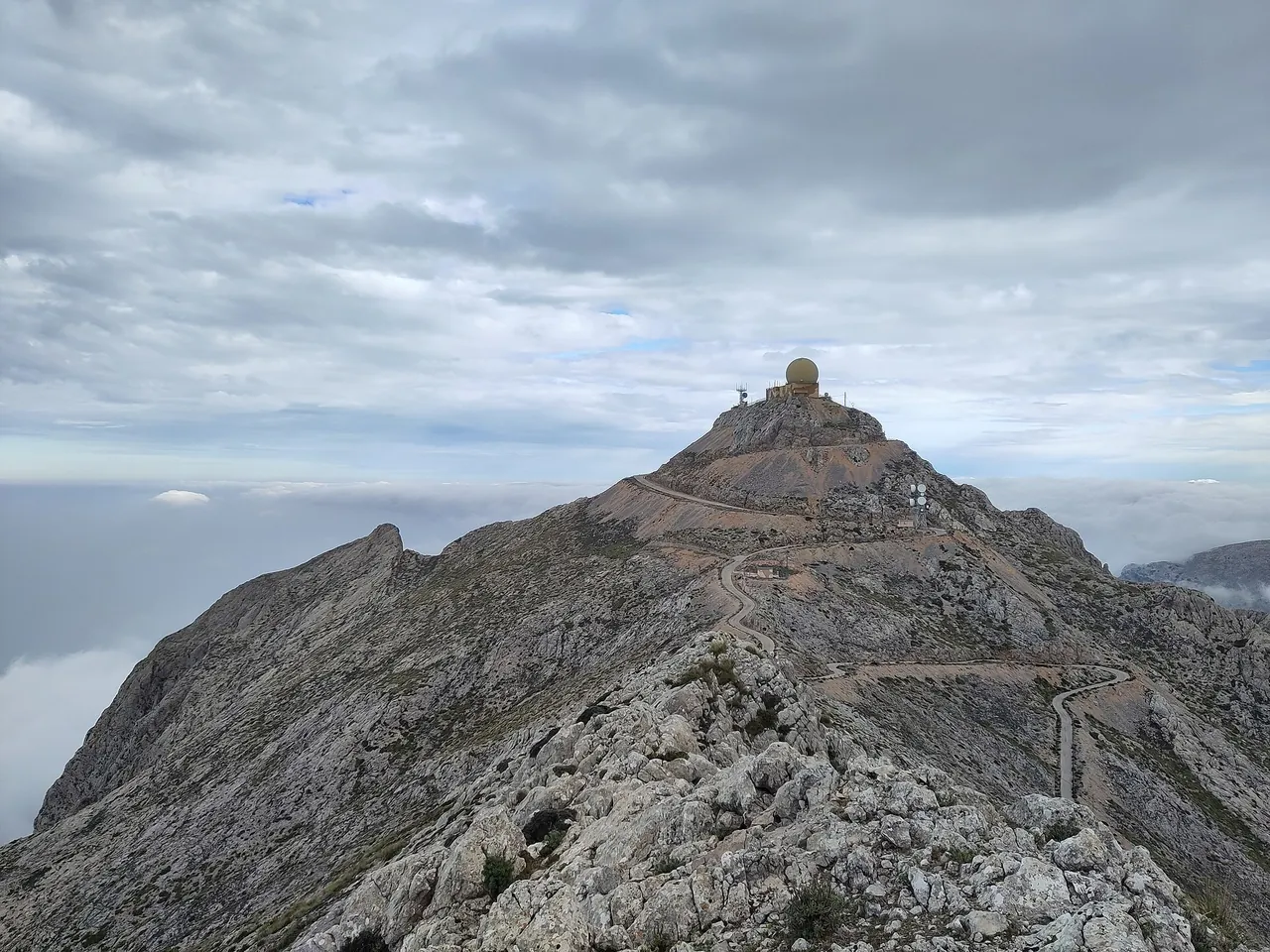
- Restrictions: The summit is a military zone and entry is forbidden; some popular trails (including to Penyal des Migdia and Morro d'en Pelut) partly enter this zone, often without permission. Do not plan to walk to the summit.
Questions and answers
Can you climb Puig Major?
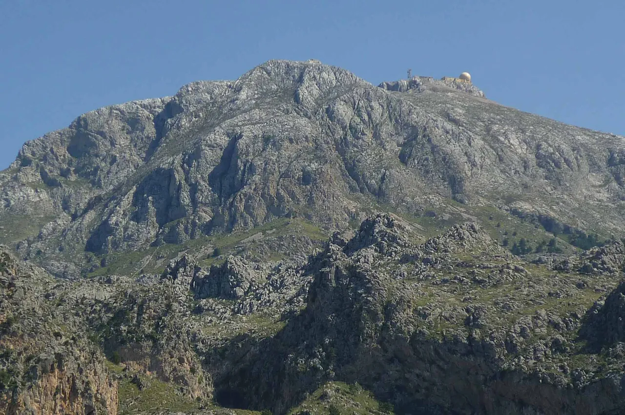
Not to the very top. The summit lies in a military zone and is closed to visitors. The English Wikipedia cites a source that speaks of a 'zone you may not enter'. There are other trails around, but do not plan to walk to the summit.
How high is Puig Major?
The height usually given is 1,445 m above sea level (the Puig Major article and the Spanish Wikipedia). The English article on the Serra de Tramuntana gives 1,436 m, so the sources disagree; use 1,445 m.
What is the dome on top of Puig Major?
It is a radar. The former US military base on 6.2 ha was built in 1957-1959 and operated until 1993; the two orange radar domes were replaced by one larger one in 2005.
Where is the best place to see Puig Major from?
Earlier research pointed to the Ma-10 and the area around Sa Calobra, but this was not confirmed at the time of our check. The only certain thing is that the summit is inaccessible; choose viewpoints according to the trails in the area, for example Puig de Massanella (its description on the portal also mentions the Puig Major military zone).
Nearby and related
Places to visit
- Sa Calobra 4.9 km
- Lluc Monastery (Santuari de Lluc) 8 km
- Sóller oranges 8.1 km
- Mallorcan olive oil (PDO Oli de Mallorca) 10.2 km
Beaches
- Port de Sóller beaches 8.5 km
Hiking trails
- GR 221 Stage 7: Tossals Verds - Son Amer 4.8 km
- Puig de Massanella hike 7.9 km
- GR 221 Stage 8: Son Amer - Pont Romà 8.5 km
- Alaró Castle hike 8.6 km
- GR 221 Stage 6: Muleta - Tossals Verds 9.7 km
Towns and villages
Festivals and events
- Es Firó, Moors and Christians in Sóller 8.4 km
- Caimari Olive Fair 10.2 km
Related
More in this region: Serra de Tramuntana
Sources
- en.wikipedia.org (accessed 2026-10-29)
- es.wikipedia.org (accessed 2026-10-29)
- en.wikipedia.org (accessed 2026-10-29)
- pomiar-osm-dojazdy (accessed 2026-10-29)
Checked 29 October 2026. Our own descriptions; figures from the sources above, with conflicting sources shown as a range.