

Key facts
| Length of Platja des Través | 610 m1,3 sources differ: 610-800 |
|---|---|
| Length of Platja d'en Repic | 250 m1,3 sources differ: 250-350 |
| Surface | coarse sand, partly with stones |
| Length | 800 m |
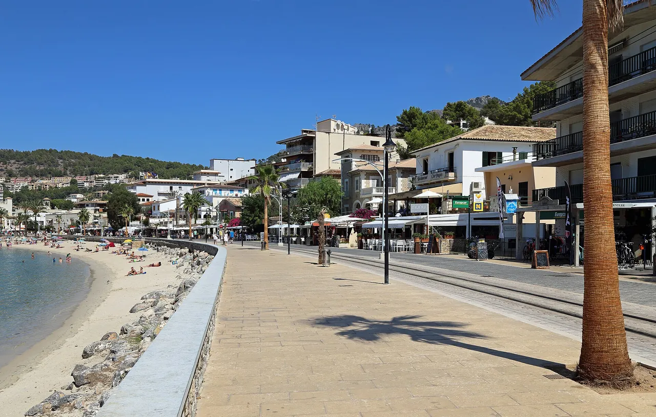
| Facilities | swimming zone separated from boats by buoys (Través), hotels and restaurants along the promenade (Repic) |
| Access | tram from Sóller to the port, car, boat; on foot along the promenade |
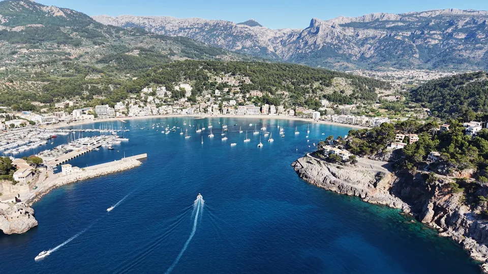
| Shelter from wind | the bay is sheltered from the north-west wind by Racó de Santa Caterina |
| Best time to go | May, June, September, October; morning or late afternoon (editorial assessment) |
| Crowds | busy in season (de.wikipedia) |
The colour next to a fact shows where it comes from: sources differ
Getting there
- To Port de Sóller; car parks in the town not confirmed.
- Restrictions: The tram reaches the town east of Repic beach; TIB line numbers have not been confirmed.
- Without a car: stop Port de Sóller, about 934 m on foot (about 12 min), lines 203, 204, 231, 232 (GTFS CTM; all places without a car)
Free parking
- Unnamed car park: about 735 m on foot, number of spaces unknown
Car parks tagged as free in OpenStreetMap (fee=no); walking distance = straight line x 1.3. All free car parks
Questions and answers
Where can I park in Port de Sóller?
Parking data was not confirmed at the time of our check. From the centre of Sóller the simplest way is the vintage tram to the port.
Can I get to Port de Sóller by tram or bus?
Yes, the tram from Sóller reaches the port (the stop is next to Platja d'en Repic). Bus line numbers have not been confirmed; check tib.org.
Is Port de Sóller beach crowded in summer?
Yes, de.wikipedia describes both beaches as busy in season.
Can I take a boat from Port de Sóller to other beaches?
Yes, boats run from the port to Sa Calobra, Cala Deià and Cala Tuent.
Nearby and related
Places to visit
- Sóller oranges 3.4 km
- Serra de Tramuntana 7.1 km
- Alfàbia Gardens 8.4 km
- Puig Major 8.5 km
- Sa Calobra 11.4 km
Beaches
- Cala Deià 5.9 km
Hiking trails
- GR 221 Stage 6: Muleta - Tossals Verds 1.3 km
- GR 221 Stage 5: Can Boi - Muleta 6.7 km
- Alaró Castle hike 8.5 km
- GR 221 Stage 7: Tossals Verds - Son Amer 10.8 km
- Archduke's Path (Camí de s'Arxiduc) 11.1 km
Towns and villages
- Sóller 3.4 km
- Fornalutx 4 km
- Deià 6.5 km
- Valldemossa 11.1 km
Festivals and events
Related
More in this region: Serra de Tramuntana
Sources
- ca.wikipedia.org (accessed 2026-10-29)
- wikidata.org (accessed 2026-10-29)
- de.wikipedia.org (accessed 2026-10-29)
- tib.org (accessed 2026-10-29)
Checked 29 October 2026. Our own descriptions; figures from the sources above, with conflicting sources shown as a range.